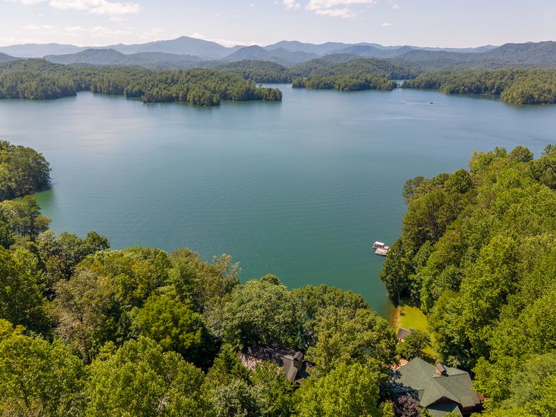
Lake Santeetlah is a 2,881-acre reservoir in Graham County, in the far western corner of North Carolina. It was created in 1928, when the Cheoah River was dammed to make hydroelectric power, and it has stayed a power company's lake ever since. Two things stand out to anyone who spends time here: how quiet the water is, and how much of the shoreline is unbroken forest. Both trace back to who owns the shore.
The lake sits at about 1,932 feet of elevation, ringed by the Unicoi Mountains. Robbinsville, the Graham County seat, is at the lake's southern end. The nearest town of any size beyond that is a long drive in any direction, which explains a lot about the pace of the place.
The numbers
- Surface area: 2,881 acres
- Shoreline: 76 miles
- Surface elevation: about 1,932 feet
- Depth: about 56 feet on average, roughly 213 feet at the deepest
- Created: 1928, by damming the Cheoah River
- Shoreline ownership: roughly 80% U.S. Forest Service (Nantahala National Forest, Cheoah District)
- Operator today: Brookfield Renewable
Seventy-six miles of shoreline on a lake of under 3,000 acres tells you the shape. Santeetlah is not a round bowl. It is a flooded river valley, all arms and coves, so the shore-to-water ratio is high and a boat ride here is mostly turning corners.
It is also deep for its size. In summer the lake stratifies, warm on top and cold below, typically from July into October. That cold deep layer is not a footnote: it is why trout can live in the same lake as bass, and why the fishing here follows a depth chart more than a shoreline. State biologists describe Santeetlah as oligotrophic, low in nutrients, which is the technical way of saying the water runs clear and the lake does not grow much algae.
Why 80% of the shoreline is national forest
The lake was built by a power company, the Tallassee Power Company (Tapoco), an Alcoa subsidiary, purely to generate electricity. Nobody in 1928 was planning a resort. The land around the reservoir was, and remains, largely national forest. When private development finally came, it was confined to a few pockets of private land, most of it in what is now the town of Lake Santeetlah on the northern shore.
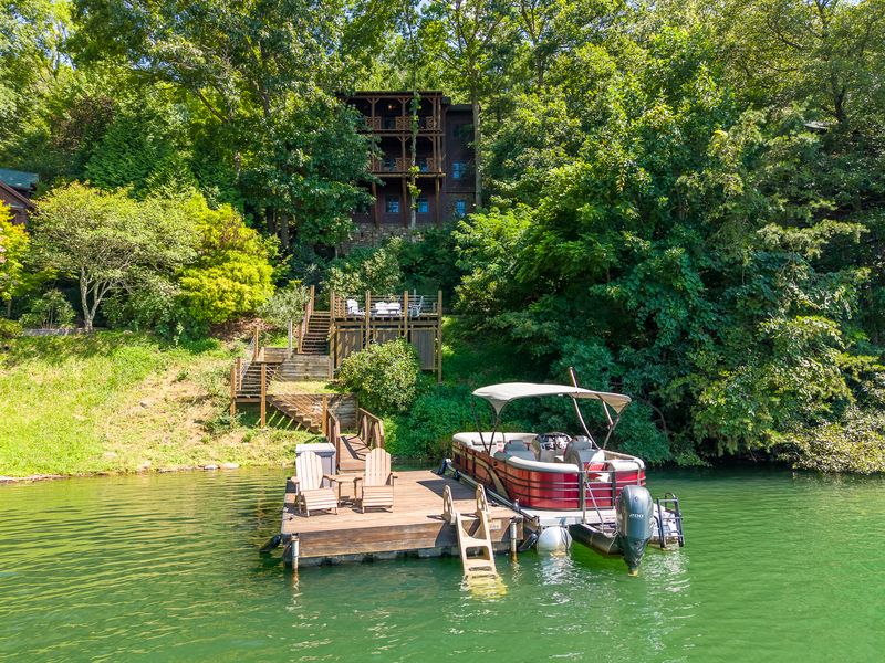
The practical effect: most of the shoreline cannot be built on, ever. Houses sit in clusters where private land touches the water, and between those clusters the shore is trees down to the waterline. Houses such as 4 Lakeside Trail sit on the town side, with 100 feet of shoreline and a private dock, but from a boat, even the developed stretches read as forest first and houses second.
The name
Santeetlah is a Cherokee word, usually translated as "blue waters." It is a fair description on a clear morning, when the lake takes the color of whatever the sky is doing. The river it flooded carries a Cherokee name too: Cheoah means "otter."
The town and the county seat
The town of Lake Santeetlah has fewer than 50 year-round residents (38 in the 2020 census) and about 200 homes, most of them second homes. It has no commercial strip. Groceries, gas, and restaurants are in Robbinsville, a few miles south, where NC-143 meets US-129. Plan accordingly: a forgotten ingredient is a real errand here, not a quick walk.
The water level moves
Because this is a working reservoir, the level is managed, not fixed. Brookfield Renewable lowers the lake seasonally, up to about 10 feet between December and March, and a smaller 4 to 5 feet during the April-to-November season. Winter exposes shoreline that summer hides, and docks sit higher above the water. The full schedule and what it means for shoreline owners is covered in our guide to the winter drawdown.
What people actually do here
Boats, mostly, at low speed and low volume. The lake has public ramps, a marina, and a lot of coves that see a handful of boats a day in high summer. Fishing is the other constant: the lake holds smallmouth and largemouth bass, walleye, crappie, trout, and muskie, and it fishes like a mountain reservoir, clear and deep. The species-by-species breakdown is in our fishing guide. For how the lake came to be in the first place, see how Lake Santeetlah was made.
Keep reading
Common questions
How big is Lake Santeetlah?
2,881 acres of surface with 76 miles of shoreline, at about 1,932 feet of elevation in Graham County, North Carolina.
Why are there so few houses on Lake Santeetlah?
About 80% of the shoreline is U.S. Forest Service land in the Nantahala National Forest, which cannot be developed. Private homes sit on the remaining pockets of private shore, mostly in the town of Lake Santeetlah.
Is Lake Santeetlah open to the public?
Yes. The lake has public boat ramps, and the national forest shoreline is public land. The lake is a working hydroelectric reservoir managed by Brookfield Renewable, so water levels change seasonally.