Graham County's northern border is Great Smoky Mountains National Park, but borders are not entrances. The park has no road in from the county's side of Fontana Lake, so a Smokies day trip from Lake Santeetlah means driving around to Cherokee and entering the way most North Carolina visitors do: up US-441 from Oconaluftee. It is a longer drive than people expect, about 52 miles and 75 minutes to the Oconaluftee Visitor Center, and it makes a full, worthwhile day if you leave in the morning and plan the stops in order.
The drive in: gorge, Bryson City, Cherokee
From Robbinsville, take US-129 south to US-74 east. The highway follows the Nantahala Gorge, where you will likely see rafters on the river below, then flattens into Bryson City at about 39 miles, a natural coffee and gas stop. From Bryson City, US-19 runs east to Cherokee, and US-441 turns north into the park at the Oconaluftee Visitor Center.
Cherokee is worth an hour on its own if you have not been. It is the seat of the Eastern Band of Cherokee Indians, and the background in our guide to Junaluska and Graham County's Cherokee history will make the rest of the day's place names mean more.
Oconaluftee: elk, a farm museum, and an easy river walk
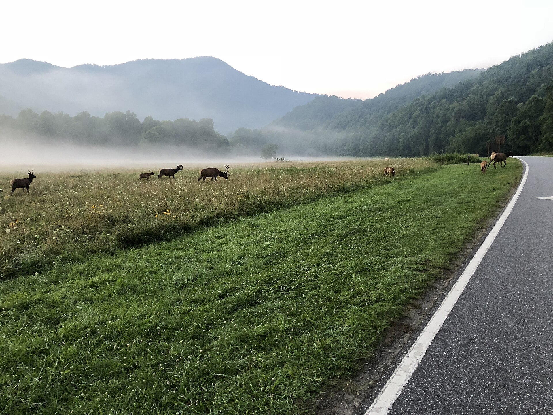
Start at the visitor center. The big meadow beside it is where the park's elk herd spends its mornings and evenings, and the reliable viewing windows are right after sunrise and in the last hour or two before sunset. Midday visitors usually see an empty field and a photograph of an elk inside the center instead. Midday is fine; just set expectations.
Next door, the Mountain Farm Museum is worth half an hour before you head up the mountain. From the same trailhead, the Oconaluftee River Trail runs about 3 miles round trip, flat and shaded along the river to the edge of Cherokee. It is also one of only two trails in the entire park where dogs are allowed, the other being the Gatlinburg Trail.
Up US-441: Mingus Mill, Newfound Gap, and Kuwohi
US-441, Newfound Gap Road, is the park's only cross-mountain highway. A few minutes north of the visitor center, Mingus Mill is a short stop most drivers pass without noticing. North from there the road climbs steadily to Newfound Gap at the Tennessee state line, trading cove forest for spruce and fir as it rises.
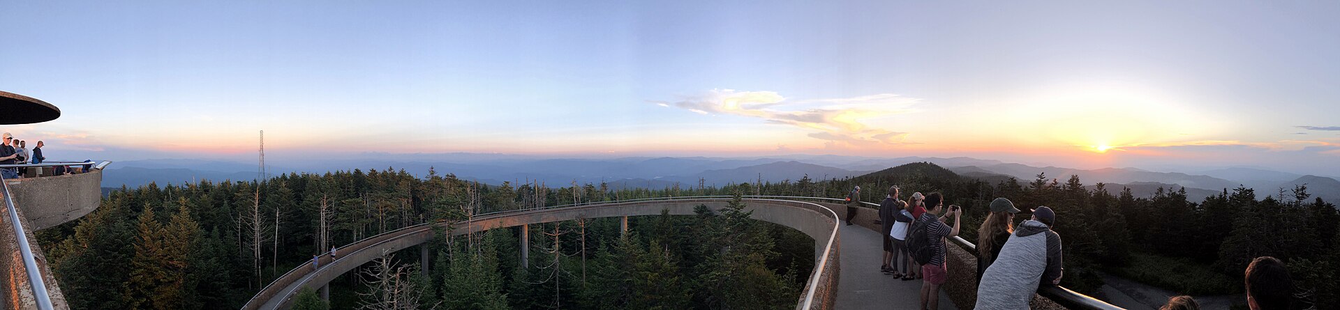
Just south of the gap, a 7-mile spur road climbs to Kuwohi, the 6,643-foot summit most maps printed before 2024 label Clingmans Dome. In September 2024 the U.S. Board on Geographic Names restored the Cherokee name, which means "mulberry place." Kuwohi is the highest point in the park and the highest point in Tennessee. From the parking lot, a paved path climbs half a mile to an observation tower; it is steep enough that the park itself warns about it. On a clear day the view from the tower reaches about 100 miles. On a typical summer day, expect layered ridges and haze instead, which is the view the Smokies are named for.
Two logistics notes. Kuwohi Road closes to vehicles every winter, December 1 through March 31. And the parking lot fills on fall weekends, so go early in the day rather than after lunch.
The shorter alternative: Fontana Dam
If a 75-minute drive each way sounds like too much car for one day, the park still touches the county at Fontana Lake. Fontana Dam, about 50 minutes from Robbinsville, is the tallest dam in the eastern United States, and the Appalachian Trail crosses directly over its top. You are in the park's boundary country the whole time, with none of the 441 traffic. Our Fontana Dam guide covers the visitor center season and the walk across.
Before you go
- The park has no entrance fee, but any vehicle parked for more than 15 minutes needs a parking tag: $5 for a day, $15 for a week, $40 for a year. Buy one online before you leave, because cell service disappears not far into the park.
- Fuel up in Bryson City or Cherokee. There is no gas sold inside the park, and the 441 climb is not where you want to test a low tank.
- Bring layers. Kuwohi at 6,643 feet is far colder than the Oconaluftee valley floor, and wind on the tower adds to it.
- Download maps offline. The gorge, Cherokee, and the park interior all have dead zones, including around the lake itself.
Keep reading
- Tail of the Dragon: A Driver's Guide from Lake Santeetlah
- 48 Hours at Lake Santeetlah: A Weekend Itinerary
Common questions
How long does it take to drive from Robbinsville to the Smoky Mountains?
About 75 minutes and 52 miles to the Oconaluftee Visitor Center near Cherokee, via US-74 through Bryson City and US-19. Fontana Dam, on the park's western edge, is closer at roughly 50 minutes.
Does Great Smoky Mountains National Park charge an entrance fee?
No entrance fee, but parking tags are required for vehicles parked longer than 15 minutes: $5 daily, $15 weekly, or $40 annual. Buy online in advance, as cell service is unreliable in the park.
When is the best time to see elk at Oconaluftee?
Early morning just after sunrise and the last hour or two before sunset, in the meadow beside the Oconaluftee Visitor Center. The herd is usually off in the woods during the middle of the day.